|
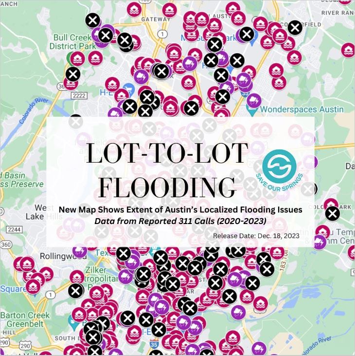
New Map Shows Extent of Austin's Local and Lot-to-Lot Flooding ProblemsDespite the fact that Edward's Aquifer is in Stage IV drought, Central Texas is vulnerable to flooding when we do receive rainfall. Austin sits in the middle of the state’s “flash flood alley” due to torrential rains. Intense storms, combined with more impervious cover from more development, will increase Austin's risk of flooding. About ten percent (10%) of Austin is already within flood zones; these areas include approximately 24,000 Austin utility customers vulnerable to flooding. The Austin City Council recently approved Phase I of the "HOME" initiative, and intends to bring a second wave of amendments (Phase II) that would include increases to allowable impervious cover -- rooftops and pavement. The first phase increased zoning entitlements on every single family lot in Austin to allow up to 3 housing units on a lot, while also decreasing lot size. However, in Phase II, the development potential on many lots drastically increases (beyond 3 units for multiple, newly subdivided lots). The resulting impact is that the impervious cover will undeniably increase flooding throughout the city, as developers take advantage of the full extent of their new zoning entitlements. This will lead to more local and lot-to-lot flooding, as well as increasing the risk in existing floodplains downslope. To help understand how the HOME initiative layers on problems to existing conditions, the Save Our Springs Alliance prepared the linked map, which locates and describes all flood-related incidents reported to the City of Austin's 311 call center between January 1, 2020, and November 21, 2023. The data shows that over the last 4 years, almost 600 flood incidents (shown in red) occurred outside of known and mapped floodplains. These data points are evidence of local and lot-to-lot flooding. About 190 flooding incidents inside mapped floodplains (shown in purple) were also reported, and, given the consequences of climate change and increased impervious cover, these types of incidents will also inevitably increase. Many potential flooding issues (approx. 150 reports) could also be traced to clogged or overstressed drainage infrastructure (in black), showing that, as Austin increases its flooding risks, the City will be challenged to keep drainage infrastructure functional. MAP LINK Local and lot-to-lot flooding is not necessarily threatening to human life but can cause Austin residents expensive property damage, complicate emergency response, and increase erosion and pollution in Austin's creeks. Next Steps Phase II of the misguided HOME initiative is anticipated to be considered in early 2024. The current proposal includes guidance to increase zoning impervious cover limits and to eliminate or reduce drainage requirements for multi-unit residential developments. The Save Our Springs will be working with our partners to reach out to City leaders, including the Austin Environmental Commission, to highlight these concerns and work towards solutions. In the meantime, please continue to speak up and raise concerns about the proposed HOME ordinance.
We wish you and yours a Happy Holiday Season! SOS Alliance Comments are closed.
|
Archives
July 2024
Categories |
Save Our Springs Alliance |
Quick Links |
SOS is a 501 c3 non profit and your donation is tax deductible


 RSS Feed
